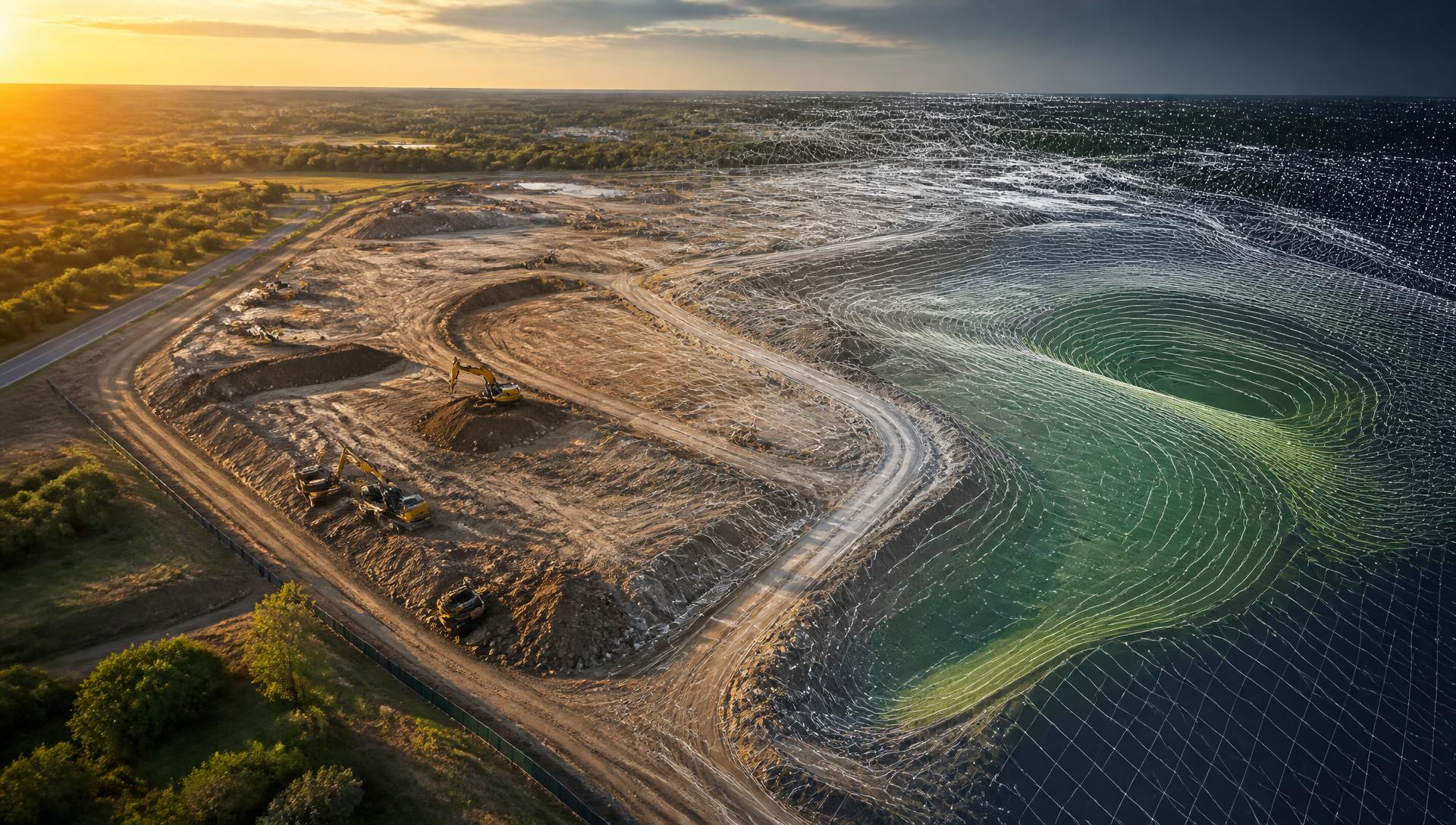
OutMedia · Aerial Intelligence
TURN YOUR PROPERTY INTO DATA.
Drone Mapping • 3D Modeling • Site Documentation • Property Intelligence
Professional drone mapping, 3D modeling, aerial documentation and site intelligence for construction, land development and property professionals.
More than a drone photo
MORE THAN A DRONE PHOTO.
Your property is more than an image.
OutMedia Aerial Intelligence uses drone imagery and photogrammetry workflows to turn real-world sites into useful digital information.
From construction progress and land development to 3D site visualization and property documentation, we help clients see their projects from a completely different perspective.
Deliverables
WHAT WE CAN CREATE
Drone Mapping
High-resolution aerial mapping for properties, construction sites and development projects.
3D Site Modeling
Turn hundreds of aerial images into an interactive 3D representation of the property or project.
Orthomosaic Mapping
Create detailed, corrected aerial maps that provide a comprehensive visual record of a site.
Terrain & Elevation Visualization
Visualize terrain, elevation changes and site conditions through digital surface and terrain models.
Construction Progress Monitoring
Create repeatable aerial documentation so project teams can compare site progress over time.
Stockpile & Volume Measurements
Where appropriate, use aerial mapping data to estimate areas, distances and material volumes.
Land & Property Mapping
Create detailed visual maps for large properties, ranches, development land and commercial sites.
Before & After Site Comparisons
Compare different capture dates to visually demonstrate changes and progress.
Sample work
WHAT THE DATA ACTUALLY LOOKS LIKE.
Technology demonstrations of UAV photogrammetry workflows — orthomosaic maps, 3D reconstructions and measurable site documentation.
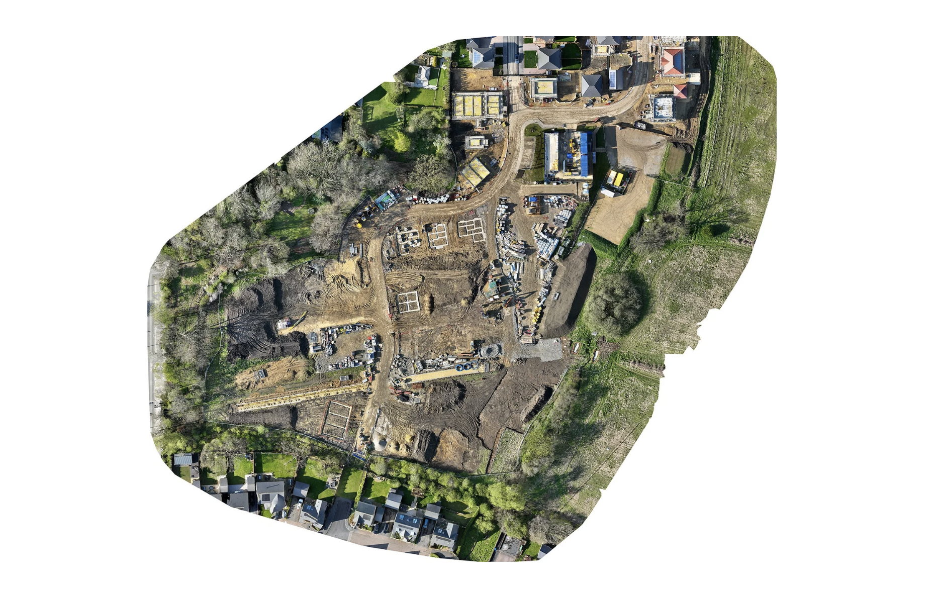
Housing development site map
Hundreds of overlapping aerial frames stitched into one corrected, top-down site map.
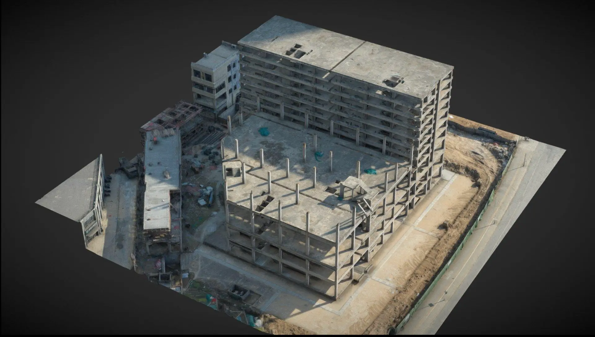
Concrete frame reconstruction
Photogrammetry turning a structure under construction into an inspectable 3D model.
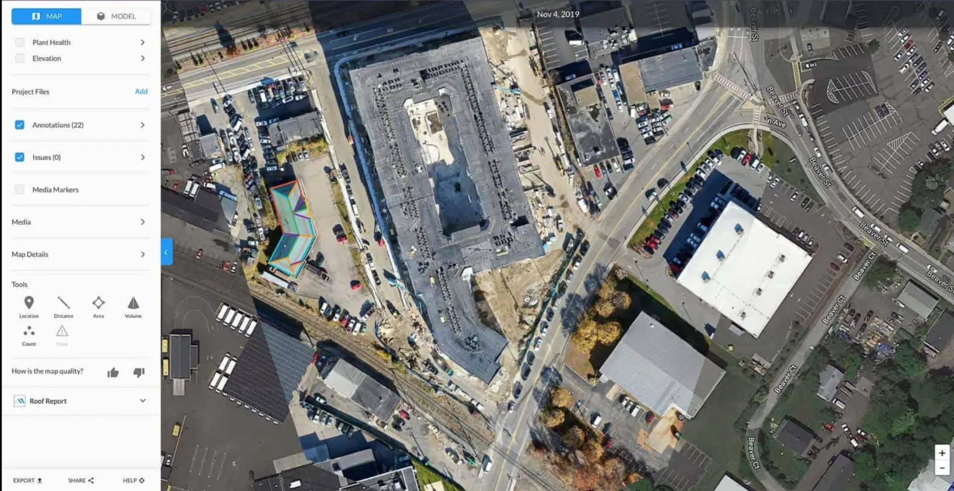
Annotated site intelligence
Maps with annotations, distance, area and volume tools for project teams.
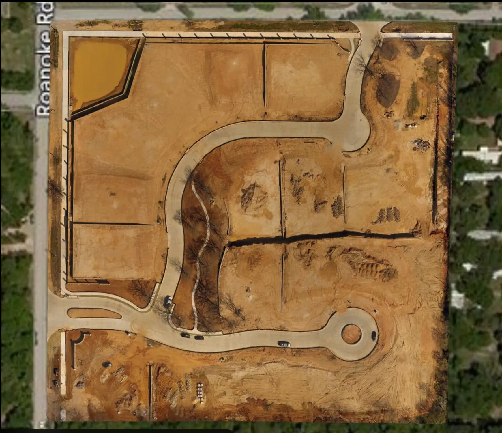
Grading & lot layout
Aerial documentation of grading, roads, drainage and lot layout across a full parcel.
Sample imagery is shown for technology demonstration purposes. Deliverables vary by site, scope and conditions. Outputs are visual documentation, not certified surveys.
View portfolio samplesConstruction drone mapping
SEE YOUR PROJECT FROM ABOVE — AND SEE WHAT CHANGED.
Construction projects change every day. OutMedia helps you create a consistent digital record of that progress.
With recurring aerial documentation, project owners, contractors, developers and stakeholders can visually compare the site from one capture to the next.
Included in a construction program
- Scheduled drone documentation
- High-resolution aerial imagery
- Orthomosaic site maps
- 3D site models
- Progress comparisons
- Site measurements
- Stockpile documentation
- Digital project archive
- Client-ready reports
Land & development mapping
- Property visualization
- Aerial mapping
- 3D terrain
- Elevation visualization
- Roads and access documentation
- Structures and site features
- Development progress
- Property marketing visuals
Land & development
UNDERSTAND YOUR LAND FROM A NEW PERSPECTIVE.
Large properties can be difficult to understand from the ground.
OutMedia Aerial Intelligence creates detailed aerial and 3D representations that help landowners, developers, builders and property professionals visualize the property as a whole.
Process
FROM FLIGHT TO DIGITAL MODEL.
Plan
We define the property, project goals, capture area and desired deliverables.
Capture
We conduct a planned aerial capture using a systematic drone photography workflow.
Process
Images are processed through photogrammetry workflows to create mapping and 3D outputs.
Deliver
You receive the agreed digital maps, models, measurements, visualizations and/or reports.
Why not just use Google Earth?
Google shows you the world.
OutMedia captures your project.
Google Earth and Google Maps are excellent tools for exploring locations and getting a general view of a property. OutMedia Aerial Intelligence is different: we capture your property specifically for your project, at the time you need it, and transform that imagery into project-specific visual and mapping deliverables.
Google Earth / Maps
General reference
- Existing imagery
- Imagery dates vary
- You don't control when the imagery was captured
- Designed primarily for viewing and navigation
- General-purpose measurements and visualization
- Not captured specifically for your construction project
- No recurring documentation around your project schedule
OutMedia Aerial Intelligence
Project-specific data
- Fresh aerial capture
- Captured for your specific project
- Defined area of interest
- Planned flight and image acquisition
- Project-specific photogrammetry workflows
- Orthomosaics
- 3D models
- Point clouds
- DSM / terrain visualization when appropriate
- Repeatable construction documentation
- Project-specific deliverables
The difference isn't just the camera.
It's the data.
Google provides existing geographic imagery and visualization tools. OutMedia can capture new imagery specifically around your project's needs and process that imagery into useful project deliverables. The value comes from capturing the right information, at the right time, for the right project.
From flight to data
HOW PROJECT-SPECIFIC AERIAL DATA IS BUILT
Your property
Planned aerial capture
Overlapping aerial imagery
Photogrammetric processing
Digital project data
Which can branch into
Only the deliverables appropriate for the specific project, capture conditions and processing workflow are produced.
Why it matters
Your project changes.
Your data should too.
01
Capture when you need it
Get current aerial documentation based on your project schedule instead of relying solely on existing imagery.
02
Capture the area that matters
Focus the mission on your property, construction site, development area or specific project requirements.
03
Build a digital record
Create repeatable aerial documentation that can help show how a project changes over time.
04
Go beyond a photograph
Depending on the project and workflow, aerial imagery can be processed into orthomosaics, 3D models, point clouds and other visual mapping products.
05
Make complex sites easier to understand
Give owners, contractors, developers and project teams a clearer visual representation of existing conditions.
Construction example
Imagine this on a construction project.
Week 1
Aerial capture
Week 4
Aerial capture
Week 8
Aerial capture
Week 12
Aerial capture
Project progress
Instead of having a single aerial photograph, recurring captures can create a visual history of the project. Compare different dates to see how the site evolves.
Aerial documentation supports project teams — it does not replace construction management, surveying or engineering services.
"But can't I just look at this on Google Earth?"
Absolutely — Google Earth is a great tool for general location research, property context and exploring the world.
The difference is that OutMedia is providing a service specifically around your project. We capture new imagery for your project, process it through appropriate aerial and photogrammetric workflows and deliver project-specific visual information.
If you need current documentation, recurring construction captures, a 3D site model, an orthomosaic or other project-specific aerial deliverables, that's where OutMedia adds value.
Google is a great map.
OutMedia is a project-specific data service.
We aren't trying to replace Google Maps or Google Earth. We use aerial technology to create information specifically for your project.
Who benefits
WHO IS THIS FOR?
Construction companies
Document site progress and existing conditions.
General contractors
Create visual documentation for project communication.
Land developers
Visualize and document larger properties and development sites.
Commercial property owners
Create current aerial and 3D documentation of properties.
Architects & design teams
Use aerial imagery and 3D visualization as part of project planning and documentation workflows.
Property & real estate professionals
Create enhanced visual representations of properties when appropriate.
Deliverables
FROM DRONE FLIGHT TO DIGITAL DELIVERABLE
01
Aerial imagery
02
Processing
03
Mapping / 3D reconstruction
04
Project deliverables
Available deliverables depend on the project, capture conditions, equipment, processing workflow and required accuracy.
Important information
OutMedia Aerial Intelligence provides aerial imaging, mapping, visualization and documentation services. Mapping and 3D products are created according to the project requirements and available data. Not every aerial mapping product is a legal land survey or engineering deliverable. Where a project requires a licensed survey, engineering certification or other regulated professional service, OutMedia will work with or refer to the appropriate licensed professional.
Don't just look at your property.
Capture it. Map it. Understand it.
OutMedia Aerial Intelligence turns aerial imagery into project-specific visual and mapping information for construction, development and property professionals.
Packages
AERIAL INTELLIGENCE PACKAGES
Aerial Documentation
Starting at $495
Ideal for property owners, builders and businesses needing professional aerial documentation.
- Planned aerial capture
- High-resolution aerial imagery
- Basic aerial mapping
- Property overview
- Digital delivery
3D Site Intelligence
Starting at $795
Ideal for construction, land development and commercial projects requiring more detailed digital documentation.
- Aerial capture
- Orthomosaic
- 3D site model
- Point cloud
- Terrain/elevation visualization
- Basic measurements
- Digital delivery
Construction Intelligence
Starting at $995/month
Ideal for active construction projects requiring recurring documentation.
- Scheduled site captures
- Updated aerial imagery
- Progress documentation
- Orthomosaic updates
- 3D model updates where applicable
- Before/after comparisons
- Project archive
- Client-ready reporting
Final pricing is customized based on property size, location, project requirements, capture frequency and requested deliverables.
Who we serve
BUILT FOR PEOPLE WHO BUILD, DEVELOP AND MANAGE PROPERTY.
General Contractors
Document construction progress and maintain a visual record of your project.
Land Developers
Visualize large properties, development sites and changing terrain.
Home Builders
Document projects from site preparation through completion.
Excavation & Dirt Contractors
Document site conditions and, where appropriate, estimate stockpile and material volumes.
Commercial Property
Create detailed aerial documentation and 3D visualization of commercial sites.
Landowners & Ranches
See roads, structures, terrain and property features from above.
Real Estate & Land Professionals
Create powerful visual presentations for land and development properties.
OutMedia Construction Intelligence
Your project changes every week.
Your documentation should too.
Monthly aerial documentation designed to give owners, contractors, developers and stakeholders a consistent visual record of project progress.
Month 1
Site prep & clearing
Month 2
Foundations & utilities
Month 3
Vertical progress
Month 4
Finish & handover
Why us
WHY OUTMEDIA?
Media + Technology
We combine professional visual production with emerging aerial mapping and 3D workflows.
One Partner
Photography, video, drone, aerial documentation and digital property visualization under one company.
Built for Business
Our deliverables are designed to help companies communicate, document and present their properties and projects.
Scalable
Start with one project and expand into recurring construction documentation, larger mapping projects and advanced aerial services.
Need traditional listing media too? Explore our commercial photography, builder programs and portfolio — one partner for photography, video, drone and aerial documentation.
FAQ
DRONE MAPPING QUESTIONS
What is drone photogrammetry?
Drone photogrammetry uses overlapping aerial photographs and specialized processing to create maps, measurements and three-dimensional representations of a property or site.
Can you create a 3D model of my property?
Yes. Depending on the property, capture conditions and project requirements, OutMedia can create 3D site models and other digital mapping deliverables.
Can you map construction sites?
Yes. Construction documentation is one of the primary applications of this service. Recurring captures can be used to visually compare project progress over time.
Can you measure stockpiles?
Aerial mapping can be used for appropriate projects to estimate areas, dimensions and stockpile/material volumes. Results depend on project conditions and capture methodology.
Is this the same as a land survey?
No. OutMedia Aerial Intelligence is a drone mapping and visualization service and does not replace a licensed land survey or engineering survey.
How often can you document a construction project?
Projects can be documented weekly, biweekly, monthly or on a custom schedule depending on the project's needs.
How large of a property can you map?
Project size depends on location, terrain, flight requirements, desired resolution and deliverables. Contact OutMedia for a project-specific assessment.
Project quote
READY TO SEE YOUR PROPERTY DIFFERENTLY?
Tell us about your property or project and we'll recommend the right aerial documentation and mapping solution.
Construction • Development • Land • Commercial • Property
OutMedia Aerial Intelligence provides drone-based mapping, visualization and documentation services. Deliverables are not a substitute for a licensed land survey, boundary survey, engineering survey or other professional service requiring licensure. Accuracy and deliverables vary by project, equipment, environmental conditions and capture methodology. When professional surveying or engineering services are required, OutMedia can coordinate with qualified licensed professionals.